Korea can be a tough place to get around if you have mobility issues and need accessible walkways. It's come a long way in the years I've been here, and taking the subway with a wheelchair, or the elderly or injured with bad legs, or even just heavily pregnant women, is overall very well accommodated these days with elevators and leveling ramps.
But what if you want to spend a little time outside the main parts of the city and take in some of the nice scenic natural spots that are around the capital and around major tourism areas? You need some way of knowing if there are any nice spots among all the hiking trails where mobility impaired folks can enjoy too.
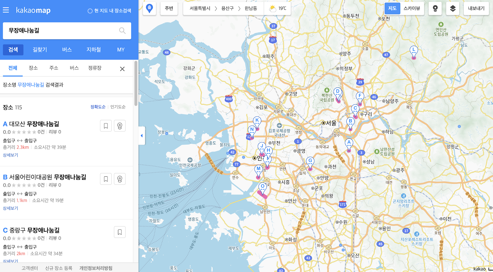
Lucky for you, Kakao Map has recently included some such locations.
 |
| Locations of some barrier-free trails around Seoul on Kakao Map |
Barrier free trails on Kakao Map
Just search 무장애나눔길 ("barrier-free paths") on Kakao Map (https://map.kakao.com/?q=무장애나눔길) and you can see a list of highlighted paths that are ensured to be flat and easily accessed by wheelchair.
Often this means in areas where the walking path isn't flat, special gently inclined wooden fenced ramps have been added to easily get around, like this:
 |
| One example of flat wooden paths built over hiking trails |
You can check the lengths and locations of the paths, such as this one around Daemo Mountain (I always want to call this place "old baldy") near Gangnam in Seoul:
 |
| Location and distance of such paths |
You can use the street view to get eye view looks at what to expect and help you decide if it's a good choice for your particular needs.
 |
| "Street view" look at some trails |
Be aware that some of this street view imagery is out of date so may not reflect the newer installed facilities.
These listings can be helpful, for example, if some of your family from back home is visiting Korea and everyone starts to get a little stir crazy sitting at home or being in the city. Of course these are good for many types of people:
- handicapped / wheelchair users
- people with injuries, on crutches
- elderly folks
- pregnant women
- families with small children in strollers or toddlers
Barrier free trails on Naver Map
 |
| Accessible trails on Naver Map |
Seoul City official map of accessibility info
You can also check out Seoul City's official online government agencies map (https://map.seoul.go.kr/smgis2/) which includes viewable layers highlighting points of interest for people with mobility issues.
For example there is a huge trove of visual data showing the suitability and accessibility of various walking areas around Seoul, giving you a granular look at places you might be visiting. Search for, or find and enable the layer for "이동약자 산책로 지도" (mobility-impaired walking paths map) to see where sidewalks are great (blue) or difficult (red) to navigate with mobility issues.
 |
| Detailed reports of the ease or difficulty of getting around Seoul in a wheelchair or with other mobility issues |
A direct link to that map is here, but you'll need to click the little handicap logo square on the left to activate it:
UPDATE:
"I once broke the wheel of my electric wheelchair while passing through a widely spaced drainage cover, so I had to call someone to repair it urgently,” she said. “Sometimes it is difficult for a manual wheelchair to pass through the stony paths as well as the palm mats that are commonly laid on the trails.”
Something to look out for. I think some of these trails are made more for just greater ease for elderly walkers than necessarily for people with disabilities.
Comments