Here is a very simple way to extract a GPX file of any bicycle directions route or walking/hiking route you can search up on Kakao Map, so that you can load the directions into any navigation or app you wish.
Background
 |
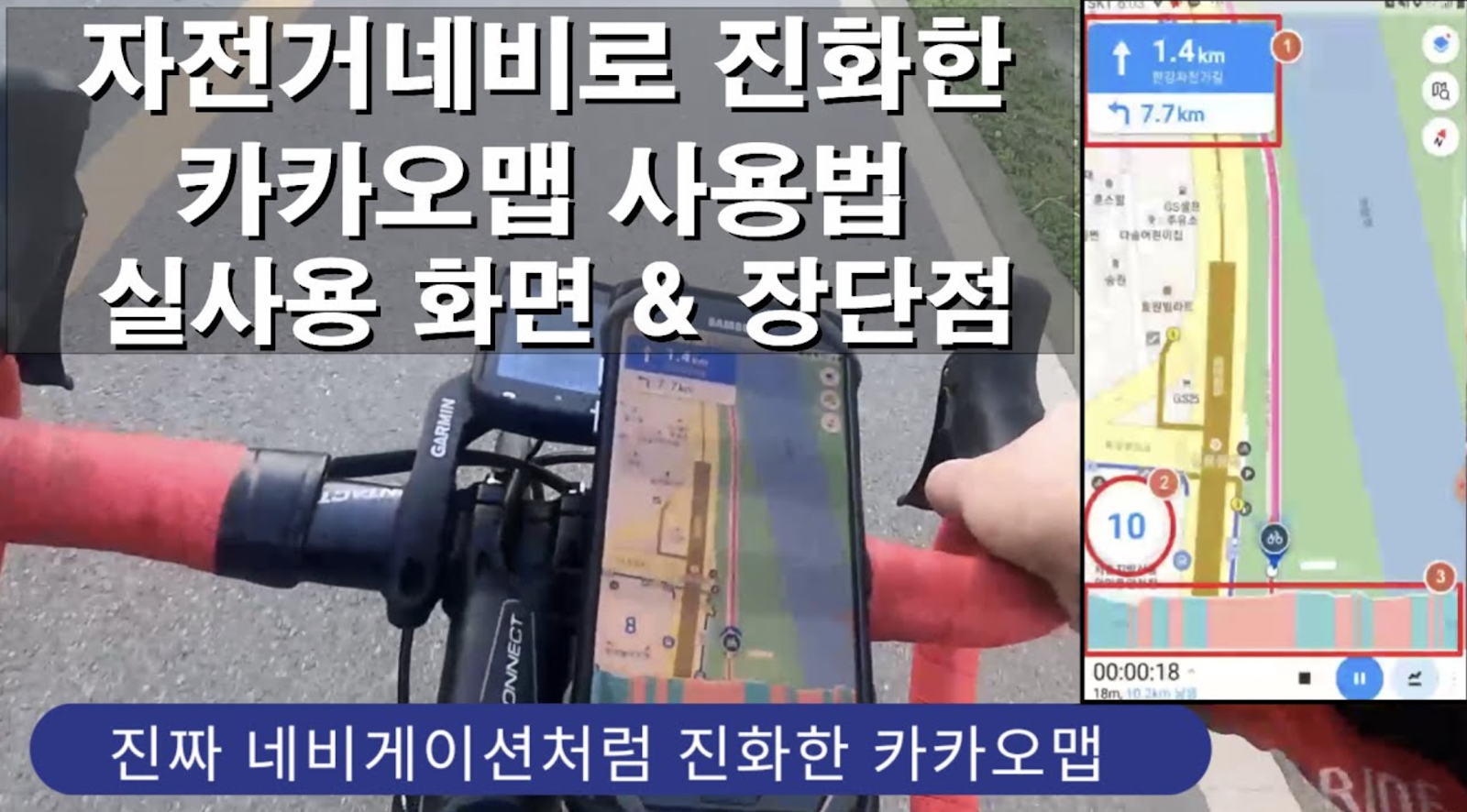
| Using KakaoMap bicycle direction navigation in real life. Screenshot from "자전거네비로 진화한 카카오맵 사용법 - 실제 사용화면 및 장단점 소개" on YouTube |
You can even get the directions on your Apple Watch:
 |
| Image: KakaoMap blog |
But what if you need these directions offline? For example, if you're a tourist without a data plan, or somehow going far from a cell phone tower (I can't imagine that's possible in Korea, but who knows)? What if you have an alternative sports app, like Strava or etc., that can load GPX files to direct you locally without any WiFi or data use?
Decent navigation directions in Korea are only found in Naver or Kakao, so in this case, it would be extremely useful to somehow extract the cycling directions from one of these services to a simple GPX file you can take where ever you want.
Bikeroute.xyz Chrome extension
Lucky for us, a Korean developer has a solution that can do this simply by installing a Chrome extension and browsing the map.
Go here to install the Bikeroute.xyz Chrome extension:
🔗 https://chrome.google.com/webstore/detail/bikeroutexyz-for-chrome/kglfobkcdlefpknbcckmlmemggfdnmcd
Its permissions only read data from the Kakao Map website, so no big worries about privacy or rouge code.
Run the extension on Kakao Map
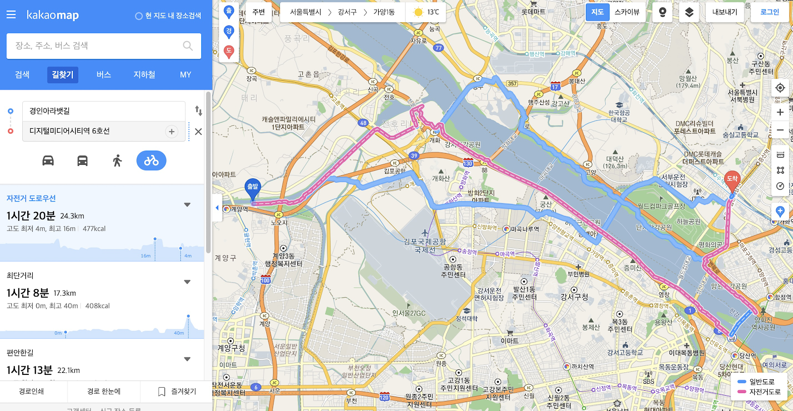
Once installed, simply go to Kakao Map and search a bicycle route you want the GPX for. For example, here is a route I searched from the Ara Waterway bike path near Gyeyang to Digital Media City Station.
The path I want is the pink one. Which ever option you prefer, click it in the left-hand column to ensure it's the highlighted pink one.
Then just tap the extension icon in your Chrome toolbar:
Now you can load up the file anywhere you want. For example, here is that exact route, now displayed in Google Earth:
Walking or hiking directions as GPX file
Although the main target of the extension seems to be cyclists, I noticed that it is also able to extract GPX files from Kakao Map walking directions. This could be ideal for hikers who want to stick to main trails, but don't want to drain their phone battery all day consulting an online map.
Here's an example route, from Suyu Station in northern Seoul up to Youngbong Mountain, making use of the map's labeled hiking routes:
Here's this one in Google Earth:
Perfect. Never get lost out on the trail again. You could potentially even add waypoints at key trail intersections so to have a large portion of the officially marked trails saved in your GPX file. Load it up on your phone and use it as your main navigation tool, or as an offline backup in case you get lost.
I tried this in Naver Maps and with other types of directions in Kakao Map, but it looks like it only works for cycling and walking and only in Kakao Map.
Great tool for enjoying more of Korea's beautiful natural scenery. Big thanks to 헌진 at 공지사항, B I K E R O U T E ... : 네이버블로그 for making this.
And a hat tip to: 자전거네비로 진화한 카카오맵의 장단점, 사용법 및 실제 사용화면 소개 | | 오해피넷


Comments