Cheongwadae (청와대), aka the Blue House, aka Korea's White House, ceased being the official presidential office this year. and opened to public after 74 years. Along with this official de-designation, the site suddenly became available on Korean mapping services, no longer being artificially blurred out on satellite views like most other sensitive government/industry locations are.
This was pointed out in a Reddit post, but the post is now deleted. So I thought I'd take a quick look just for anyone curious. Since KakaoMap has a history feature that lets you compare past and present coverage, we can easily see the difference.
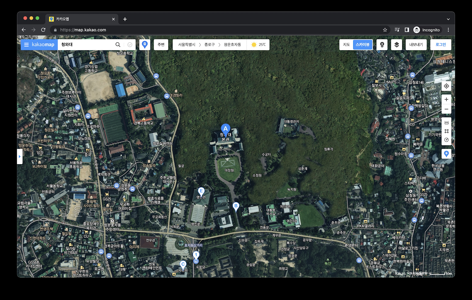
Here is what the site looks like now on KakaoMap. This is the "most recent" image, as of 2022. But it looks awfully similar to the imagery from the previous available time, 2020, so I am guessing it may be the same imagery with the relevant portions unblurred.

Here's the version from 2020 with the entire area fully shaded/censored. The labels are just from the current overlay.

I also noticed that in the 2015 imagery, a different type of shading is used. This one looks much more natural and less obvious censorship. I actually like that they seem to have changed to the "total overgrowth" type shading, because imagery like this here too easily can lead one to believe that this is open, accessible hiking land. It peeves me so much that I wrote an entire post complaining about this habit:
Notes on online map blurring in South Korea for hikers or tourists

And just for comparison, here are the three above pictures combined into a GIF.

Here's a little closer satellite view from KakaoMap.
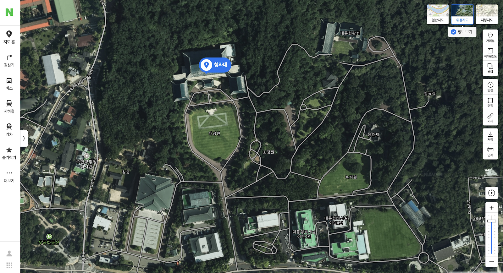
And here's the same view from Naver Map, which seems to include a little more detail.

I wondered if Google would have anything different, but the image quality was pretty low.

 |
| PhotoSphere outside the Blue House. Image: Google Map |
None of the map services have street view in the compound, but Google did have a few user uploaded Photo Spheres from the area, such as this one.
 |
| Image: KyeongHan News |
And as a result of the opening, some of the hiking trails in the area have opened up after many long years too. Here you can see the current/older trails in orange, and the newly opened trails in green:
Anyway I just thought it was interesting that the portals so quickly were able to uncensor this site.
Comments